Posts

Showing posts with the label hiking wisconsin

Hiking Kohler Andrae State Park [Wisconsin]

Image
  “Named for John Michael Kohler and Terry Andrae state parks, Kohler-Andrae is the home of majestic  sand dunes, miles of golden beach, shimmering blue Lake Michigan water, whispering pines, an abundance of wildlife and recreational activities. Kohler-Andrae State Park is one of the last natural preserves along the  Lake Michigan shore and is open for everyone to explore and enjoy.”  https://dnr.wisconsin.gov/topic/parks/kohlerandrae I did this hike at Kohler Andrae Stake Park on a weekend afternoon in late November. The park is located in  Sheboygan, Wisconsin (about an hour north of Milwaukee). I arrived in the early afternoon and left the park just before sunset. The temperatures were in the mid 40s. The wind was pretty aggressive along the lake,  however, as you will surely hear reflected in the audio. The park can get very crowded during the summer, as it features direct access to beaches on Lake Michigan, so it was refreshing to e...

Hiking the Kettle Moraine State Forest (WI) - Pike Lake Unit

Image
  Where is Pike Lake? Pike Lake is located in Hartford, Wisconsin -- approximately 40 minutes from Milwaukee and 1 and 1/2 hours from Madison or Green Bay. Why visit Pike Lake? In addition to Pike Lake, itself, the Pike Lake Unit is home to Powder Hill. Powder Hill, a glacial kame, is one of the highest points in southeastern Wisconsin, at 1,360 feet. An observation tower just below the peak of the hill provides scenic views of the surrounding area. The Ice Age National Scenic Trail also runs through the Pike Lake Unit. There are opportunities for camping, swimming, hiking, fishing, picnicking and more! What should one expect on the trails at Pike Lake? There are 5 loop trail options, ranging from around .5 miles to almost 5 miles. Around 2.5 miles of the Ice Age Trail also runs through the Pike Lake unit, with around a mile of that overlapping some the unit's loop trails.  The trails are mostly forested, with some open, grassy meadows nearer the lake. They are generally wide ...

Hiking Kettle Moraine State Forest (WI) - Northern Unit [Parnell Tower Trail]

Image
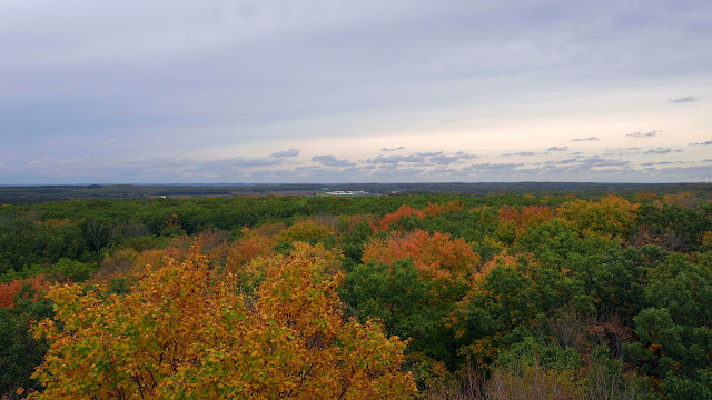
  Where is Parnell Tower? Parnell Tower is located about an hour north of Milwaukee, near Plymouth Wisconsin. The trailhead is located on County Highway U (Kettle Moraine Scenic Drive). Why visit Parnell Tower? The top of the 60-foot Parnell Tower is the highest point in the Kettle Moraine State Forest. The observation tower offers scenic views of surrounding farmland, geological features created by glaciers, and the city of Sheboygan. Visibility on a clear day extends in excess of 20 miles. What should one expect on the Parnell Tower Trail? Experienced hikers will find the Parnell Tower Trail to be a relatively easy hike. Those who do not hike often may consider this a hike of moderate difficulty. There are quite a few stairs leading up to the tower and a couple of inclines that could be viewed as rather steep along the trail. A small portion of the trail overlaps with the Ice Age National Scenic Trail. For a longer hike, consider parking at the Highway 67 parking lot for the IA...

Hiking and Camping at Wyalusing State Park - [Wisconsin]

Image
Where is Wyalusing State Park? Wyalusing State Park is located in southwestern Wisconsin, where the Wisconsin and Mississippi Rivers converge. It is about 2 hours west of Madison and about 20 minutes from Prairie du Chien. Why visit Wyalusing State Park? If possible, plan in advance and reserve a campsite on the bluffs, overlooking the Mississippi River. In addition to the spectacular views, the park offers ample opportunities for hiking and biking, a canoe trail, and a boat launch.The park is also a popular spot for picnicking and bird watching and is home to Native American burial mounds.  What should one expect on the trails at  Wyalusing State Park ? Wyalusing State Park hosts over 14 miles of hiking trails. Trail descriptions can be found  here. There are some tremendous views along the Mississippi Ridge Trail, Bluff Trail and Sentinel Ridge Trail. There's also a cave to explore along the Bluff Trail! The Old Immigrant Trail provided close-proximity views of t...

Hiking and Camping at Blue Mound State Park - [Wisconsin]

Image
Where is Blue Mound State Park? Blue Mound State Park is located about 25 miles west of Madison, Wisconsin. Why visit Blue Mound State Park? Blue Mound State Park is situated on the highest point in southern Wisconsin, providing scenic views from two observation towers. The park also offers some unique geological features, over 20 miles of hiking/biking/skiing trails, a family campground, hike/bike-in campsites, access to the Military Ridge State Trail, and even a swimming pool!   What should one expect on the trails at Blue Mound State Park ? With over 20 miles of trails, there are options for most hikers. Trails are mostly wide, dirt surfaces, winding through hardwood forests. They are well-marked and easy to follow. On certain trails, hikers will need to be prepared for stairs and some steep inclines. Check out the  trail descriptions to help build your hiking itinerary. Highlights of the trails include the observation towers, the opportunity to observe and learn about ...

Backpacking Wisconsin's Northwoods: [Northern Highland - American Legion State Forest]

Image
Why visit Northern Highland - American Legion State Forest? The forest, at over 236,000 acres, covers portions of three counties and has more than 900 lakes within its borders. A variety of recreational opportunities are available, including hiking, biking, camping, canoeing, kayaking, and boating. During the winter, snowshoeing, cross country skiing, and snowmobiling are popular activities. Where is Northern Highland - American Legion State Forest? Northern Highland - American Legion State Forest is located in northern Wisconsin. Nearby cities, in the area of the state affectionately known as "The Northwoods," include Rhinelander, Eagle River and Minocqua. The forest is located approximately four hours from Milwaukee, 3 and 1/2 hours from Madison, and three hours from Green Bay.   What should one expect on the trails in Northern Highland - American Legion State Forest? On our last trip, we visited the Escanaba Trails and the Lumberjack Trails, which are linked by a connecti...

Hiking Horicon Marsh State Wildlife Area

Image
Where is Horicon Marsh State Wildlife Area located? Horicon Marsh State Wildlife Area is located near the city of Horicon, in Dodge County, Wisconsin. Horicon is about an hour northwest of Milwaukee. The hiking trails are located off of Highway 28, with parking available at the DNR Service Center and International Education Center.  There are also hiking trails located in the Horicon National Wildlife Refuge, which lies directly to the north of Horicon Marsh State Wildlife Area. The National Wildlife Refuge is run by the U.S. Fish and Wildlife Service, while the State Wildlife Area is run by the Wisconsin Department of Natural Resources. Additionally, the Wild Goose State Trail runs just to the west.  What should one expect on the trails at Horicon Marsh State Wildlife Area? Horicon Marsh is the largest freshwater cattail marsh in the United States. There are five miles of hiking trails in the Horicon Marsh State Wildlife Area, which illustrate the three main wildlife habitat...