Posts

Showing posts from October, 2021

Backpacking the Dolly Sods Wilderness [Monongahela National Forest - West Virginia]

Image
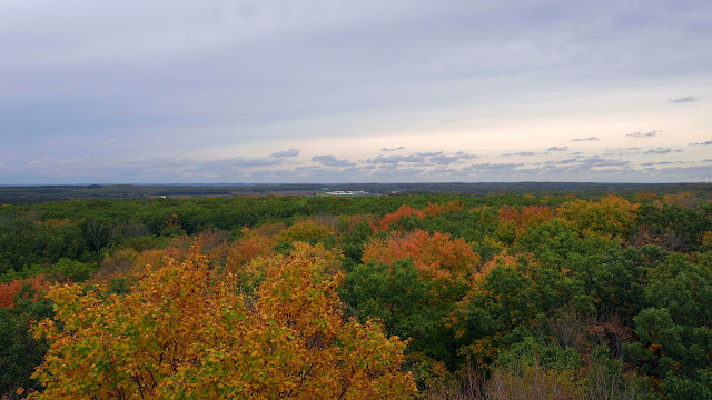
Where is Dolly Sods? Dolly Sods is located in the Allegheny Mountains of eastern West Virginia, within the Monongahela National Forest.  Why visit Dolly Sods? Dolly Sods is the highest plateau east of the Mississippi River, with altitudes from around 2,600 to 4,000 feet. The wilderness area offers a variety of landscapes but is perhaps best known for its windswept meadows and extensive bogs. There are nearly 50 miles of hiking trails and several prominent overlooks, providing scenic views of the surrounding mountains and valleys. Link to .pdf of Forest Service map What should one expect on the trails at Dolly Sods? Before even hitting the trails, know that this is a rather remote area. Allow extra time to reach your parking destination, as the forest roads are narrow and littered with rocks and potholes. The trailheads are accessible by passenger car, but a high clearance vehicle would be preferable. It took me about an hour to ascend the last 8 miles of unpaved forest road to access

Hiking Kettle Moraine State Forest (WI) - Northern Unit [Parnell Tower Trail]

Image
  Where is Parnell Tower? Parnell Tower is located about an hour north of Milwaukee, near Plymouth Wisconsin. The trailhead is located on County Highway U (Kettle Moraine Scenic Drive). Why visit Parnell Tower? The top of the 60-foot Parnell Tower is the highest point in the Kettle Moraine State Forest. The observation tower offers scenic views of surrounding farmland, geological features created by glaciers, and the city of Sheboygan. Visibility on a clear day extends in excess of 20 miles. What should one expect on the Parnell Tower Trail? Experienced hikers will find the Parnell Tower Trail to be a relatively easy hike. Those who do not hike often may consider this a hike of moderate difficulty. There are quite a few stairs leading up to the tower and a couple of inclines that could be viewed as rather steep along the trail. A small portion of the trail overlaps with the Ice Age National Scenic Trail. For a longer hike, consider parking at the Highway 67 parking lot for the IAT, w

Hiking and Camping at Wyalusing State Park - [Wisconsin]

Image
Where is Wyalusing State Park? Wyalusing State Park is located in southwestern Wisconsin, where the Wisconsin and Mississippi Rivers converge. It is about 2 hours west of Madison and about 20 minutes from Prairie du Chien. Why visit Wyalusing State Park? If possible, plan in advance and reserve a campsite on the bluffs, overlooking the Mississippi River. In addition to the spectacular views, the park offers ample opportunities for hiking and biking, a canoe trail, and a boat launch.The park is also a popular spot for picnicking and bird watching and is home to Native American burial mounds.  What should one expect on the trails at  Wyalusing State Park ? Wyalusing State Park hosts over 14 miles of hiking trails. Trail descriptions can be found  here. There are some tremendous views along the Mississippi Ridge Trail, Bluff Trail and Sentinel Ridge Trail. There's also a cave to explore along the Bluff Trail! The Old Immigrant Trail provided close-proximity views of the river.